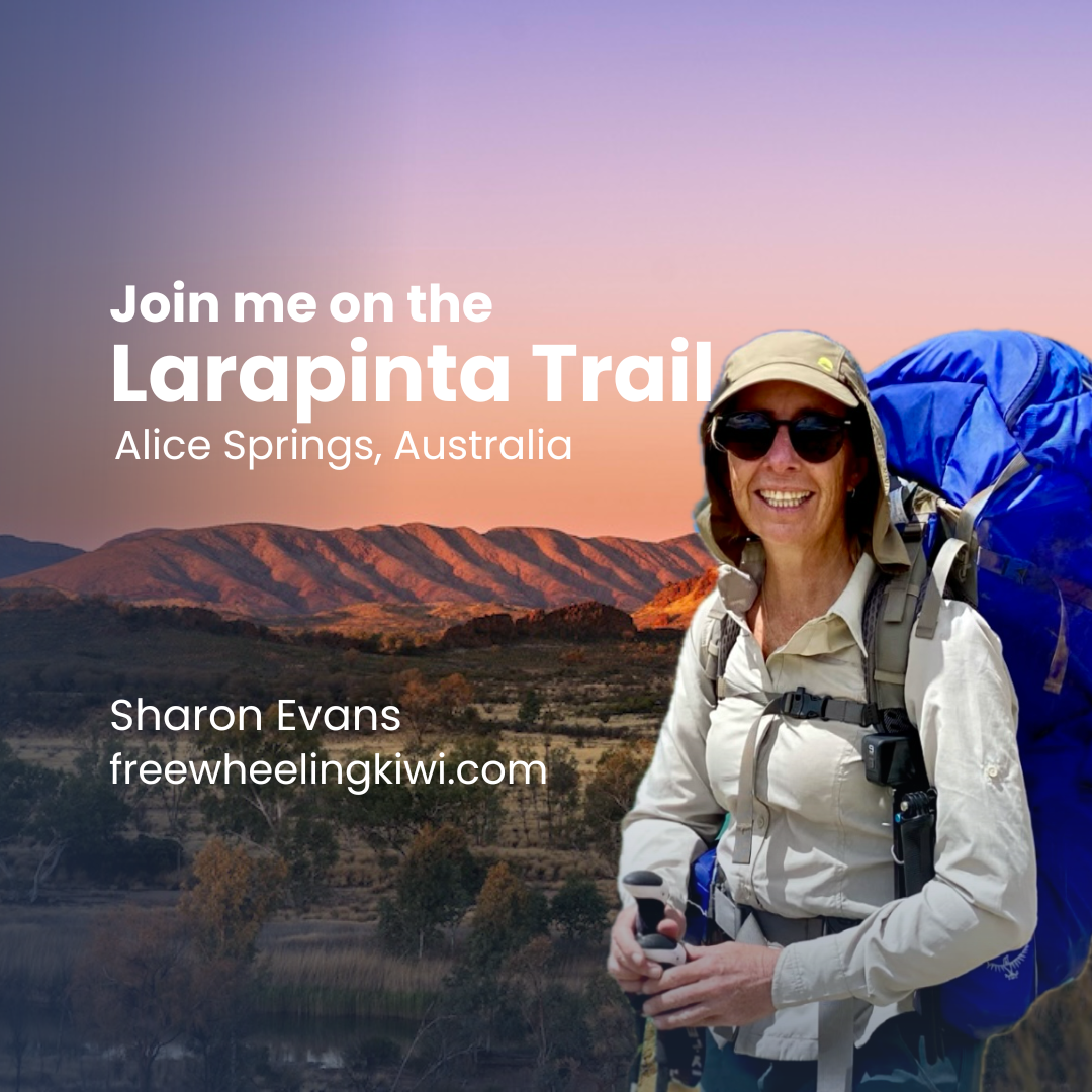
Larapinta Trail
Join Sharon in the heart of the Australian Outback
Tjorita / West MacDonnell National Park
Northern Territory, Australia

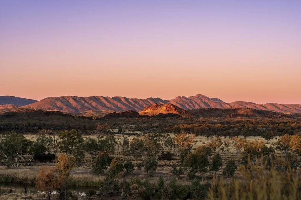
Mount Sondor, Larapinta Trail, West MacDonnell Ranges
iStock.com/ Marianne Purdie
I’m thrilled to be returning to Alice Springs, Australia and this time to walk the iconic Larapinta Trail, a 230km long distance walking trail.
Ranked as one of the planet’s top 20 treks, the Larapinta Trail follows the rocky spine of the West MacDonnell Ranges from Alice Springs Telegraph Station to Mount Sonder.
It will be a challenging and rewarding experience featuring diverse landscapes, uniquely Australian flora and fauna and fascinating Aboriginal heritage.
Who’d like to join me?

Larapinta Trail, West MacDonnell National Park
iStock.com/ Marianne Purdie
Larapinta Trail Highlights
Immerse yourself in the Tjorita / West MacDonnell National Park
Experience Australian outback camping under the stars
Learn about the fascinating local Aboriginal heritage, culture and history
Discover for yourself Simpson’s Gap, Ellery Creek Big Hole, Ormiston Gorge and Standley Chasm
View the magnificent sunrise from the top of Mount Sonder (1,389M)
Explore the spectacular West MacDonnell Ranges with its ancient metamorphic and igneous rock and nearly 600 species of flora
Trip Basics
Dates: Wednesday, 18th June to Monday, 30th June 2025
Trip Length: 12 days, 11 nights
Trip Style: Australian Outback Hiking
Accommodation Type: Camping
Meals: Breakfast, Lunch and Dinner
Host: Sharon Evans
Price: NZD $1,975 inc GST
Deposit: NZD $395. A 20% non-refundable deposit is payable on booking
Balance: Payable 30 Days prior to tour starting or immediately if already inside that timeframe.

Standley Chasm, Larapinta Trail, West MacDonnell Ranges
iStock.com/ bennymarty
Itinerary
Day 1
Alice Springs Telegraph Station to Simpson’s Gap (24.7 km - 9 hours)
You will get views back over Alice Springs and the surrounding lowlands. Good birdwatching opportunities.
Day 2
Simpson’s Gap to Jay Creek (26.2 km - 8.5 hours)
Walk through the home of the few brushtail possum colonies in Central Australia. Explore a landscape of rock outcrops over 2 billion years old.
Day 3
Jay Creek to Standley Chasm (13.6 km - 5.5 hours)
A challenging walk through some of the steepest and most rugged country in the ranges. The low route is available to those with an average level of fitness.
Day 4
Standley Chasm to Birthday Waterhole (17.9 km - 8.5 hours)
The trail follows the high quartzite ridges of the Chewings Range to the summit of Brinkley Bluff, where you will be rewarded with breathtaking views in all directions.
Steeply descending from the Bluff, the trail enters Stuart's Pass, an upper branch of the Hugh River. It then follows this river valley to Birthday Waterhole.

Black footed wallaby, Simpsons Gap, Larapinta Trail, West MacDonnell Ranges
iStock.com/ bennymarty
Day 5
Birthday Waterhole to Hugh Gorge (14.9 km - 9.5 hours)
This challenging section of the trail passes through Spencer Gorge, along the spine of Razorback Ridge and then down the narrow Linear Valley to the junction with the Hugh River.
The trail follows natural watercourses and you may need to wade or swim through pools of water in Hugh Gorge.
Day 6
Hugh Gorge to Ellery Creek (28.9 km - 10.5 hours)
This section takes you across the Alice Valley from Hugh Gorge, in the Chewings Range, towards Ellery Creek Big Hole in the Heavitree Range.
Day 7
Ellery Creek to Serpentine Gorge (12.8 km - 5 hours)
Walkers have an opportunity to enjoy expansive views across the Alice Valley, before passing through the Heavitree Range. The gently undulating terrain allows for a faster walking pace.
Day 8
Serpentine Gorge to Serpentine Chalet Camp (13 km - 5.5 hours)
Exhilarating views of the high quartzite ridgelines typical of the West MacDonnell Ranges, including Haasts Bluff and Mount Zeil, which is the highest point in the Northern Territory (NT).
Day 9
Serpentine Chalet Camp to Ormiston Gorge (28.9 km - 12 hours)
This is one of the more difficult sections of the trail and takes you into the rugged heart of the range country. There is no reliable surface water along the way, so you will have to carry your entire day’s supply of drinking water.

Serpentine Gorge, Larapinta Trail, West McDonnell Range
iStock.com/ otofritz16
Day 10
Ormiston Gorge to Finke River (8.9 km - 4 hours)
This has some steep ascents and is one of the shorter sections of the Larapinta Trail. This section winds through limestone hills at the headwaters of the Finke River, one of the world's oldest rivers.
Day 11
Finke River to Redbank Gorge (15 km - 9.5 hours)
The first part of the trail goes across spinifex-covered hills with the spectacular backdrop of Mount Sonder, then crosses the Davenport River and climbs to a hilltop lookout.
It descends to shady and peaceful Rocky Bar Gap at the base of Mt Sonder. It passes through this gap and travels along the southern side of Mt Sonder to Redbank Creek.
Day 12
Redbank Gorge, summit Mount Sonder return (15 km - 6 hours)
It’s a big climb to the peak of Mt Sonder but is worth the effort as there are breathtaking views in all directions. If the weather forecast is good, we’ll aim for an early start so that we can enjoy the sunrise from the summit.
The view looks over ranges, plains, valleys and salt lakes. This is a place to experience the grandeur of the desert landscape.
Transfer back to Alice Springs

Sunset from Mount Sonder, Larapinta Trail, West MacDonnell Ranges
iStock.com/ burroblando
Inclusions
Lightweight trekking food supplied
Three meals a day during the trek. Breakfast (x 11) Lunch (x 12) and Dinner (x 11)
Tjorita / West MacDonnell National Park Fee
Larapinta Trail Fee
Camp Site Fees
Standley Chasm Entrance Fee
Food Re-Supply Drop Box Fees
Group Emergency Communication Device
Transfer from Redbank Gorge trailhead to Alice Springs
Pre-trip get together, briefing and dinner the day before the trip starts. Dinner at your cost.
The Larapinta Trail trip is hosted by our Freewheeling Kiwi founder, Sharon Evans, and is for those of you who would love the opportunity to immerse yourself in nature, learn new skills, gain confidence and most importantly, make lifelong friends!
Exclusions
Accommodation in Alice Springs before and after your Larapinta adventure
Airfares and/or other transport to Alice Springs
Alcoholic drinks and beverages
Hot drinks during trek; bring your favourite tea or coffee
Personal travel insurance
Hiking equipment such as sleeping bag, tent, hiking poles
Snacks during trek
Breakfast on the first day, dinner on the last day
Pre-trip get together dinner in Alice Springs
Any other expenses that are not mentioned in the Inclusions section

Ormiston Gorge, Larapinta Trail, West MacDonnell Range National Park
iStock.com/ bennymarty
Accommodation
We will sleep each night at the designated Larapinta Trail campsites which are located at the beginning of each section. On Day 4, we will reach Standley Chasm and will camp at the privately operated Standley Chasm campsite.
The campsites are basic enabling you the full outback experience. After all that walking you’ll likely retire to your tent early having ended the day watching a spectacular sunset and later, the opportunity for stargazing.
Campsite facilities include a composting toilet and water tank. Some of the sites provide a shelter and picnic table.
Standley Chasm campsite has showers.
Where possible, there’ll be opportunity for a refreshing dip in the waterholes.
Hiker Responsibilities
Each hiker is responsible for carrying and caring for their own pack, camping and cooking equipment., food and personal items.
Depending on your personal requirements, when fully loaded, your pack may weigh upwards of 15 to 20 kilograms.
On arriving at the campsite, you will assemble your tent and prepare your own meals.
As a Group, we will of course support each other in all activities. We’ll start the day together and finish together, no one will be left behind.
Bring with you:
a smile, good vibes and positivity
a sense of humour and flexibility
an open mind, gratitude and curiosity
a can do attitude, patience and sense of shared responsibility
consideration and respect for others and the culture that you are visiting
Leave at home:
luxury items - to put it simply, don’t overpack
Your Host
Join Sharon Evans, founder of Freewheeling Kiwi to create lifetime memories in the heart of the Australian Outback.

Sharon Evans
Background image; Gum trees, Standley Chasm, Larapinta Trail, West MacDonnell National Park. iStock.com/ bennymarty
Larapinta Gear and Equipment
Once you’ve booked, we’ll provide you with a detailed gear list and maps along with other important information to help you prepare yourself for our epic Larapinta Adventure.
Trail Conditions
The Larapinta Trail introduces you to an exciting topography including some steep, rocky ascents and descents. The trail is well marked and traverses wide open plains, undulating hills, slips through gorges and over mountainous, rocky terrain.
Elevation ranges from 680 metres above sea level right up to the high point on Mount Sonder at 1,380 metres. In between, there’s many ups and downs.
Is the Larapinta Trail right for you?
The Larapinta Trail is a challenging trail and requires good fitness, with ideally previous experience in back country camping and multi day hikes where you have carried your own pack.
On average you will be hiking around eight hours a day covering around nineteen kilometres.
The shortest day will take about four hours and the longest possibly more than nine.
The least kilometres travelled in a day will be nine and the most will be twenty nine.
Contact Sharon if you’ve any queries about your fitness and ability to complete this walk. To make it easy to discuss the adventure in detail, we will arrange for a video call.
West MacDonnell Ranges from Mount Sonder, Larapinta Trail
iStock.com/ Trung Nguyen
Weather
To find out about weather conditions for the area, go to the Bureau of Meteorology website.
Typical weather from May to August is clear and sunny, often with a chilly breeze.
The June average minimum temperature is 5.2 degrees celsius and the average maximum temperature is 19.9 degrees celsius.
You will need warm clothes such as thermal base layers,, a warm hat or beanie and a sleeping bag rated for temperatures lower than -5°C. It’s likely to be frosty overnight.
Outside of these months the weather is warm to very hot, often reaching temperatures over 40°C.

Mount Sonder, Larapinta Trail, West MacDonnell National Park
iStock.com/ burroblando
Questions?
Contact Sharon if you’ve any general queries about this adventure or if you’re unsure about your fitness and ability to complete this walk.
To make it easy to discuss the adventure in detail, we will arrange for a video call.
Optional Tour Extension
Uluru, Kata Tjuta and Kings Canyon
A trip to the Red Centre is incomplete until you’ve visited the iconic Uluru!
On completion of the Larapinta Trail, Andrew and I plan to hire a vehicle and do a four day / three night tour encompassing King’s Canyon, Uluru / Ayers Rock, and Kata Tjuta. At each of these places, we will take time to explore the local trails and shorter day walks.
This return four day road trip will cover around 1,200 kilometres.
If interested in joining us on a shared cost basis, let me know when booking the Larapinta Trail.
Dates: 2nd July - 5th July.
Freewheeling Kiwi Group Trips
Freewheeling Kiwi Group Trips brings likeminded people together to explore incredible destinations while engaging with and caring for our natural world.
All Trips are hosted by our Freewheeling Kiwi founder, Sharon Evans, and are for those of you who would love the opportunity to immerse yourself in nature, learn new skills, gain confidence and most importantly, make lifelong friends!
The best things in life happen when we're outside of our comfort zone and until we push our boundaries, we'll never know what we like or what we're capable of. Time in nature is for all of us however sometimes knowing where to start, how to prepare or what to expect can be a little overwhelming.
We’re here to help and encourage you on your way, providing you with a safe and supported environment to lay down those building blocks.
West MacDonnell Ranges from Mount Sonder, Larapinta Trail
iStock.com/ Trung Nguyen